
Second US tropical storm in a week drenches Texas
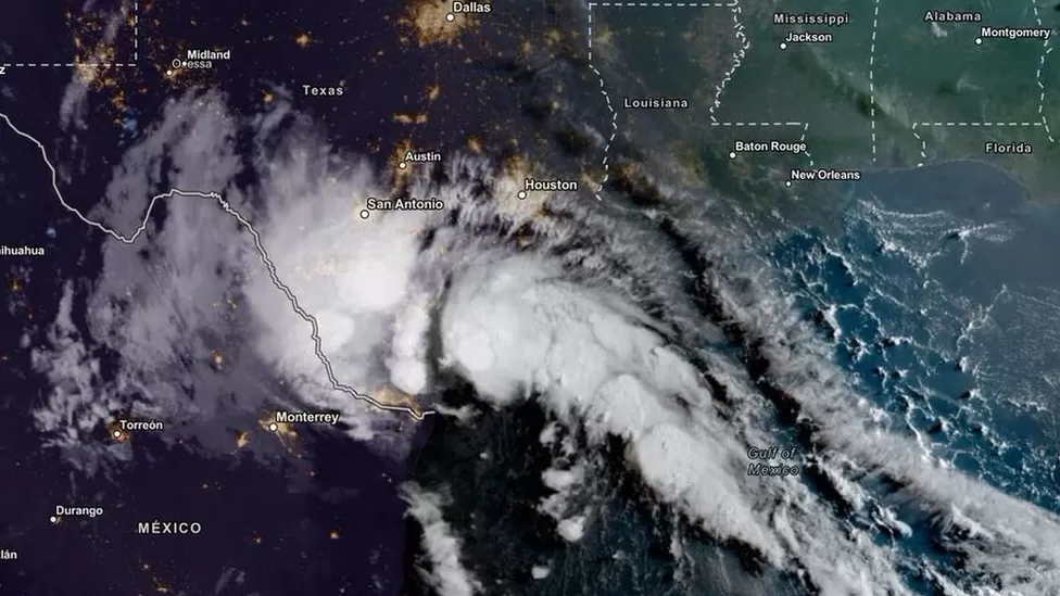
The tropical storm Harold made landfall on the south-east coast of Texas on Tuesday, bringing more heavy rain and high winds to the southern US.
In some parts of the state, the storm dumped up to 7 inches (17.7 cm) of rain.
The storm had been downgraded to a tropical depression by late Tuesday afternoon, but heavy rains continued.
There were more than 23,000 people without power in the Lone Star state on Tuesday night.
Texas received a deluge a day after parts of the south-western US were flooded by historic rains.
Floods caused by Storm Hilary caused widespread damage in California and Nevada on Tuesday.
On Tuesday, Tropical Storm Harold made landfall on Texas’ Padre Island in the Gulf of Mexico.
There were tropical storm warnings from the Rio Grande river – along the southern boundary of the state – to Port O’Connor, about 250 miles (400km) north.
Flash flooding still posed a threat, the NWS said.
Governor Greg Abbott said the state has deployed rescue boats, search-and-rescue teams, and National Guard platoons to help.
Outside of Corpus Christi, wind gusts of 59 mph were reported.
Across the hot and dry landscape of Texas, the storm was expected to carry rain, wind and hail farther inland.
On Wednesday, rain was expected to taper off.
Tropical storm Franklin is currently 230 miles east of the Dominican Republic as Texans endure the deluge.
From Wednesday, Puerto Rico can expect up to 6 inches of rain from Franklin.
Although the impact of climate change on storm frequency has yet to be determined, we do know that increased sea surface temperatures warm the air above and provide more energy for hurricanes, cyclones, and typhoons to form. Consequently, they are likely to be more intense with more extreme rainfall.
Global temperatures have already risen by about 1C since the industrial era began, and they will continue to rise unless governments make steep cuts to emissions.